Waypoint file Format
***Muss überarbeitet werden, MaxPunkte kann weitere Datenformate xml, cup, gpx und kann in andere Formate exportieren.***
MaxPunkte uses a subset of CompeGPS waypoint format. If you already have a CompeGPS wpt-file, then there is a good chance to use it directly in MaxPunkte. See this sample file for the format. MaxPunkte only accepts WGS-84, no other map datum is allowed! MaxPunkte only uses DD:MM:SS or DD:MM.mmm position format, nothing else!
Make shure, that your flight recorder is switched to WGS-84 before upload, especially the MLR.
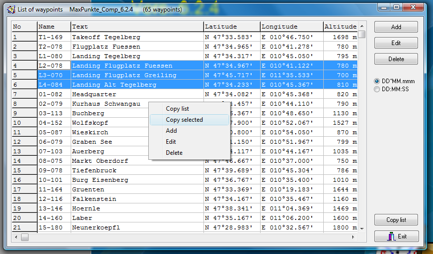
MaxPunkte shows the waypoints in the map display, you can edit them with a double click on the waypoint or in the waypoint list, which is in the waypoints menu. Very self-explaining. The right mouse click in the map are opens a context manu. One option there is creating a waypoint at the mouseclick point.
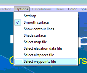
The waypoint file is selected in the options menu like the map, elevation and airspace files. MaxPunkte will load the last used files with every start of the software.
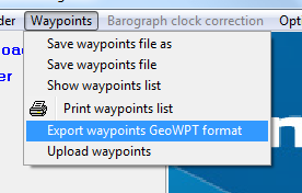
Working with waypoints is in the waypoints menu.
Editing, deleting, and adding new waypoints is in the waypoints list. There exists a contect menu (click right mouse button) for these actions. Save the waypoint file before exiting MaxPunkte or changes are lost.
The copy-functions copy the whole list or a selected part to the clipboard. It can then be pasted to another application like Excel.
The upload waypoint menu opens an upload to common flight recorders.
Export to GeoWPT format produces a waypoint file compatible with the fs scoring software. This feature and the contect menu are implemented since version 6.2.4.